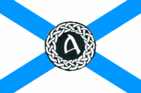
Alba Nuadh

| |
| Subdivision of: | NAL |
| Cities: | |
| Capital: | Calaidh Na Rí |
| Largest: | Calaidh Na Rí |
| Other: | TBD |
| Languages: | |
| Official: | Gaeilg, Scots, Francien |
| Others: | Montanhés, Mi'kmaq, several German dialects |
| Govrenor/Riaghladair: | TBD |
| Area: | 61,771 mi² |
| Population: | TBD New Scottish |
| Established: | 1555 (as Acadia), Royal Charter |
| Admission to NAL: | 1803 (1st) |
| This article is a proposal
|
New Scotland, or Alba Nuadh, was the first province to sign the Solemn League and Covenant establishing the North American League.
Administration
Government
Administrative Divisions
New Scotland is divided into 4 Districts, each of which are further subdivided into Counties
- Acadia (Fort LaTour)
- Île Royale (Louisbourg)
- Île Saint-Jean (Port La Joye)
- New Rothesay (Halifax)
History
Pre-League and Early League History
The territory that later became New Scotland was inhabited by the Mi'kmaq nation at the time of first contact. The Italian explorer John Cabot visited present-day Cape Breton in 1497. The first European settlement in New Scotland was established by France, lead by Pierre Dugua, Sieur de Monts. They established the first capital for the colony Acadia at Port Royal in 1604 at the head of the Annapolis Basin.
In 1620, the Plymouth Council for New England, under James II and VI designated the whole shorelines of Acadia and the Mid-Atlantic colonies south to the Chesapeake Bay as New England. In the latter 1620s, a group of Scots was sent by Charles I to set up the colony of New Scotland. However owing to the signing of a peace treaty with France, the territory was given to the French and the Scots ordered to abandon their mission before their colony had been properly established.
The French took control of the Mi'kmaq and other Native territory. In 1654, King Louis XIV of France appointed aristocrat Nicholas Denys as Governor of Acadia and granted him the confiscated lands and the right to all its minerals. British colonists captured Acadia in the course of King James III's War but Britain returned it to France at the peace settlement. It was recaptured in the course of King James IV's War and its conquest confirmed in the Treaty of Utrecht of 1713. France retained possession of Île St Jean (Prince Gereint Island) and Île Royale (Cape Breton Island) on which it established a fortress at Louisbourg to guard the sea approaches to New Francy. This fortress was captured by American colonial forces, then returned by the British to France.
Thus mainland New Scotland became a British colony in 1713, although Samuel Vetch had a precarious hold on the territory as governor from the fall of Acadian Port-Royal (Annapolis Royal) in October 1710. British governing officials became increasingly concerned over the unwillingness of the French-speaking, Catholic Acadians, who were the majority of colonists, to pledge allegiance to the British Crown, then James IV and VIII. The colony remained mostly Acadian despite the settlement of a large number of mostly German foreign Protestants along the South Shore in 1750.
The colony's jurisdiction changed during this time. New Scotland was granted a supreme court in 1754 with the appointment of Jonathan Belcher and a legislative assembly in 1758. After the French Revolution, the French colonies of Île Saint-Jean and Île Royale began drifting from New Francy, and, for a brief period, became a de facto state, known simply as Île Saint-Jean et Île Royale. In 1808, the islands petitioned the NAL for admission. They were initially governed as a territory, with some advocating their admission as a new province, and others advocating their annexation to New Scotland. Two years later, after a referendum in the islands, they were joined to New Scotland, but retaining a degree of autonomy. Shortly afterwards, the large Francophone western parts of New Scotland attained a similar status.
During the first half of the 19th century, a flood of immigrants from highland Scotland entered the province, largely in Île Royale. These Scots dominated the island, and, as a result, the island was split off as another District.
Aroostook War
In the 1830's, uncertainty between the borders of New Scotland and Massachussets Bay resulted in rising tensions between the two provinces, culminating in the so-called Aroostook War, a bloodless conflict, which was settled by a four-party conference, consisting of representatives of the federal government of the NAL, representatives of the involved provinces, and representantives of Queen Victoria I. The treaty granted most of the disputed territory to Massachussetts Bay.
The Kingdom of New Scotland
Shortly after the conclusion of the Aroostook War, several prominent leaders of New Scotland called for secession. A resolution was passed by the Novascotian legislature in 1845 declaring New Scotland a sovereign kingdom, with Victoria as its Queen. Claims to independence were soon after dropped, but a small independence movement survives in the province to this day. It is noteworthy that the resolution of independence was never formally repealed.
Later History
The early 20th century saw several major technological developments based in New Scotland. Alexander Graham Bell settled in Île Royale, basing a major laboratory there, and the Italian Guglielmo Marconi sent the first radio signal, also from Île Royale.
In the 1970's, the Parti Acadien arose, advocating the establishment of a new province from the Districts of Acadia and Île Saint-Jean, to be known as Acadia.
Geography
Borders
New Scotland is bordered by:
North: New Francy, Mueva Sefarad
West: Massachussets Bay
South: Atlantic Ocean
East: Atlantic Ocean