Chinese East Africa
| This article is a proposal
|
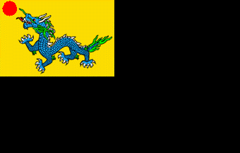
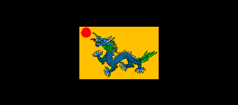
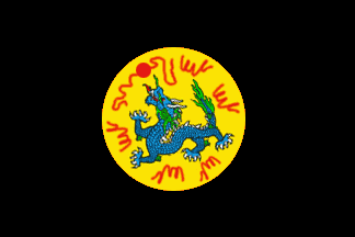
Chinese East Africa was a semi-unified confederacy of Chinese-ruled states that existed continuously from the 1400's to 1994, when it was formally dissolved by its remaining constituent members. It was formally reinstituted in 2000 as the East Africa Treaty Organization (or EATO for short). Many around the world still call the organization "Chinese East Africa" in maps and in publications, primarily for the Chinese minority that still lives throughout the area, but that is no longer an official name for the organization. Nevertheless, East African Chinese is still an official lingua franca of the organization along with Swahili, and the East African yuan is its primary currency of trade.
As this organization now stands as the EATO, it consists of little more than the following: a common defense pact, a common currency based on the Chinese yuan, an open trade and border area, and an international council (much like a miniature League of Nations).
Geography
Borders
East Africa is bordered on the north by Buganda, Maasai and Ethiopia, on the south by Mutapa and on the west by Katanga and the native states of Africa.
Area
CEA covered the area of *here*'s Northern Mozambique, Malawi, Tanzania, southern Kenya and Comoros. It used to be much larger, until the Oriental War crisis, covering Katanga, Buganda, Kasai, Maasai and Madagascar. At the conclusion of the War, these parts were partitioned away from CEA to various other countries. By the peace treaty written by the Allied Powers, Barotseland was ceded to Kemr, and Kasai, Kivu, Buganda, Malawi, and Mozambik became independent states. In addition, a new nation, named Zanzibar, was carved out of the eastern coast of the Tanganyika province and gained sovereignty over the islands of Ngazidja and Mwali, while the island of Mayota was given to France. From 1952 to 1975, the CEA thus consisted of Tanganyika, baHutu, baTwa, Nairobi, and Mombasa. By 1994, before the CEA officially ceased to exist, it only consisted of Nairobi and Mombasa, or the land which is now called Kenya.
The EATO, as of 2012, now consists of the countries of Rwanda, Burundi, Tanganyika, Kenya, Malawi, and Msumbiji, with Zanzibar as an associate member.
History
Original Article on CEA:
Following Admiral Zheng He's explorations of the 14th century, China established trading colonies in eastern Africa and Madagascar. At that time, Chinese-influenced territory spanned from Somaliland in the north on down to South Africa. A large inland territory was also claimed, though most of China's activities were along the coast. The Kingdom of Madagascar was once part of CEA, After the Great Oriental War, China was broken up into several states along traditional cultural and linguistic lines. Madagascar came under the Commonwealth's sphere of influence, and Katanga, Kasai and Buganda declared themselves independent, as the Chinese could not control them. Madagascar has since sought formal admission to the Commonwealth.
From the 1970's through the 1990's, the CEA began to break further apart until its last two official members, Nairobi and Mombasa, declared themselves as autonomous kingdoms of the new federation of Kenya and finally expelled the Chinese East Africa Company from governance over the region. It still engages in private business in its former territory, operates a few embassies, and advocates for the rights of ethnic Chinese.
The organization now unofficially known as Chinese East Africa was reestablished as the East Africa Treaty Organization in 2000, with many of the original members becoming members of the new organization by 2001. The main difference is that the leadership is majority ethnic African rather than ethnic Chinese.
Many people around the world still know the organization by the name "Chinese East Africa" and call it so in publications and maps for a variety of reasons, including the following: it is a shorter and more distinct name (because East Africa refers to an entire region of Africa, and not just this territory), and much of the international business and politics in this region is still conducted in East African Chinese. In addition, the organization did not exist for only about 6 years (from 1994 to 2000), and many historians see the pre-1994 East Africa Organization as equivalent in structure to the modern one, with the only difference being that the organization has fewer ties to the Chinese mainland.
As a result, the former colonial territory of Chinese East Africa is today a much reduced country and is ruled as a kind of condominium between the constituent states.
| This article is source material
|
- See: Africa's oldest map unveiled (BBC)
- See: Ancient Chinese Map Of Africa Poses Unanswered Questions (Hindustan Times)
- See: 1492: The Prequel (NY Times)
- See: Ancient Chinese Explorers (PBS Nova)
In light of these articles, I wrote to Jan in January:
"Any thoughts about all this and how it might affect what we think about CEA? The rest of the world?
Frankly, if those monstrous 400 to 500 foot long vessels are not exaggerations, I am quite sure that China would have been able to absolutely dominate SE Asia against the quite smaller European vessels and fleets that would be comming in from the West.
How might these behemoths (with their huge fleet of attendant ships) affect Europeans if such should sail into Lisbon or London (as we have imagined)? How might European ship building technology have changed if a number of these ships were in some way "appropriated for study"?
The thought strikes me that we may either be quite underestimating the potentials of Chinese naval power at the time or perhaps we should assume that, like *here*, the seven great voyages of the treasure junks were it and the Chinese put an end to such sea voyages. Especially given how Europe seems to have dominated the region."
CHINESE EAST AFRICA
Before the Great Oriental War, Chinese East Africa had 22 provinces. Name is first transcribed in English, then in pinyin:
- Bakonjo (ba2kon4zhou4): annexed by Ethiopia in the early 1800's
- baHutu (ba2hu3du4): became the independent nation of Rwanda in 1975 and joined the East Africa Treaty Organization in 2000
- Barotseland (ba2lo3zi4guo3, the guo as in Zhongguo): ceded to Rhodesia colony of Kemr in 1949, now part of the nation of Mutapa
- baTwa (ba2dua4): became the independent nation of Burundi in 1985 and joined the EATO in 2001
- Buganda (bu4gan4da2): became a vassal of the CEA in 1942 after the Borderland War, regained its independence in 1949
- Bunyoro (bun4you3lo2): annexed by Ethiopia in the early 1800's
- Kasai (ka2sai4): separated into an independent state in 1949
- Kivu (ki2wu4): became a native state in 1952
- Malawi (ma2la2wei4): became an independent kingdom in 1952 and joined the EATO in 2001
- Mayota (ma2you3da2): became an overseas department of France
- Mwali (mo3a2lei4): became a district of the Komori province of Zanzibar in 1949 with Zanzibar being a full member of EATO from 2000-2002 and an associate member from 2012-present
- Mombasa (mon4ba2sa4): became a kingdom of Kenya in 1994 with Kenya becoming a member of the EATO in 2001
- Mozambik (mo3san4bei4): became the independent republic of Msumbiji in 1949 and joined the EATO in 2000
- Nairobi (nai2lo2bei4): integrated into the federation of Kenya in 1994 with Kenya becoming a member of the EATO in 2001
- Ngazidja (na2zi4zhai4): became a district of the Komori province of Zanzibar in 1949 with Zanzibar being a full member of EATO from 2000-2002 and an associate member from 2012-present
- Tanganyika (tan3gan1ni2ka1): became an independent kingdom in 1984 and joined the EATO in 2000
QUERY: Do these names fit with actual Chinese names for lands in the region (see map in one of the above articles)?


