Uploads by Nik
From IBWiki
Jump to navigationJump to search
This special page shows all uploaded files.
| Date | Name | Thumbnail | Size | Description | Versions |
|---|---|---|---|---|---|
| 16:44, 13 May 2007 | Ezo flag.gif (file) |  |
5 KB | 2 | |
| 15:58, 13 May 2007 | Ezo-Snorist flag.png (file) |  |
2 KB | The flag of the SNORist Republic of Ezo | 1 |
| 19:10, 14 April 2006 | Dragoon movement.png (file) | 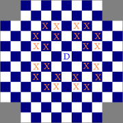 |
4 KB | 1 | |
| 11:51, 28 March 2006 | Antarctica.png (file) | 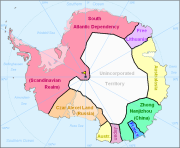 |
79 KB | Added Japanese claim | 4 |
| 20:15, 21 February 2006 | Centrafrican flag.gif (file) |  |
3 KB | Flag of the Centrafrican Empire Category:Flags | 1 |
| 22:46, 19 February 2006 | Pacific Ocean.jpg (file) | 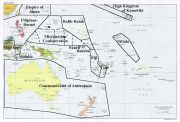 |
163 KB | Map of known Pacific States in IB. Category:Maps | 1 |
| 22:52, 27 December 2005 | Florida.jpg (file) | 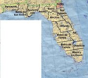 |
69 KB | Map of the ''distritos'' of the former ''Estado de la Florida'', Florida-Caribbea Category:Maps Category:Florida-Caribbea | 1 |
| 13:51, 21 December 2005 | South Chella.png (file) | 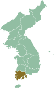 |
24 KB | Map of Corea showing location of South Chella Category:Maps Category:Corea | 1 |
| 23:21, 20 December 2005 | South Hamgien.png (file) | 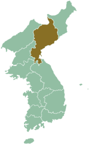 |
24 KB | Map of Corea showing South Hamgieñ's location Category:Maps Category:Corea | 1 |
| 21:18, 8 December 2005 | Japan flag.png (file) |  |
3 KB | 1 | |
| 21:17, 8 December 2005 | TAR-flag.png (file) |  |
2 KB | 1 | |
| 21:09, 8 December 2005 | Luquiu flag.png (file) |  |
4 KB | Corrected flag of Lùquiù | 1 |
| 13:48, 7 December 2005 | Kongo flag.gif (file) |  |
3 KB | Flag of Kongo Category:Flags | 1 |
| 00:57, 3 December 2005 | Nam Viet flag.gif (file) |  |
1 KB | Flag of Nam Viet Category:Flags | 1 |
| 15:57, 30 November 2005 | Greek flag.gif (file) |  |
884 bytes | Uploaded from FOIB site | 1 |
| 15:47, 30 November 2005 | Paulownia.png (file) |  |
30 KB | Symbol of the Prime Minister of Japan Category:Japan | 1 |
| 15:23, 30 November 2005 | Kanawiki flag.gif (file) |  |
5 KB | Uploaded from FOIB | 1 |
| 20:25, 29 November 2005 | Meidji-do.png (file) | 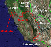 |
126 KB | Map showing location of Meidji-do relative to AC and Montrei | 1 |
| 19:51, 29 November 2005 | Yamato.png (file) | 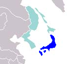 |
16 KB | Map showing the location of Yamato within Japanese Empire Category:YamatoCategory:Maps | 1 |
| 19:50, 29 November 2005 | Ezo.png (file) | 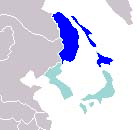 |
15 KB | Map showing location of Ezo within Japanese Empire Category:MapsCategory:Ezo | 1 |
| 19:49, 29 November 2005 | Corea.png (file) | 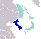 |
16 KB | Location of Corea with Japanese Empire | 1 |
| 18:19, 29 November 2005 | Yamato flag.gif (file) |  |
1 KB | Flag of the Kingdom of Yamato, a constituent of the Empire of Japan, and temporary flag of the latter | 1 |
| 18:14, 29 November 2005 | Corea flag.gif (file) |  |
3 KB | Flag of the Kingdom of Corea, a constituent of the Empire of Japan | 1 |
| 18:09, 29 November 2005 | Luuquiuu flag.gif (file) |  |
5 KB | Flag of the Kingdom of Lùquiù | 1 |
| 18:05, 29 November 2005 | Ceuta civil flag.gif (file) |  |
2 KB | Civil flag of Ceuta Category:Flags | 1 |
| 18:04, 29 November 2005 | Ceuta state flag.gif (file) | 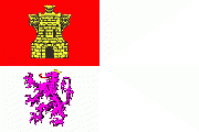 |
9 KB | State flag of Ceuta Category:Flags | 1 |
| 18:02, 29 November 2005 | Ubangi-Shari flag.gif (file) |  |
2 KB | Flag of the former colony of Ubangi-Shari Category:Flags | 1 |
| 18:01, 29 November 2005 | Abd el-Kadr Flag.gif (file) |  |
2 KB | Flag of Abd el-Kadr's revolt Category:Flags | 1 |
| 17:59, 29 November 2005 | ENR flag.gif (file) | 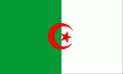 |
3 KB | Flag of the Etoile Nordafricain Category:Flags | 1 |
| 17:58, 29 November 2005 | Centrafrican Republic flag.gif (file) | 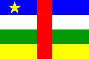 |
2 KB | Flag of the former Centrafrican Republic Category:Flags | 1 |
| 17:57, 29 November 2005 | CAE airforce roundel.gif (file) |  |
3 KB | Air Force roundel for the Centrafrican Empire Category:Flags | 1 |
| 17:55, 29 November 2005 | Cape Green GG.gif (file) |  |
7 KB | Governor-General of Cape Green's flag Category:Flags | 1 |
| 17:54, 29 November 2005 | Cape Green flag.gif (file) |  |
4 KB | Alternate flag of Cape Green Category:Flags | 1 |
| 17:51, 29 November 2005 | CI civil flag.gif (file) | 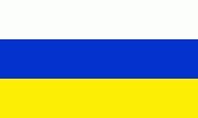 |
2 KB | Civil Flag of the Canary Islands Category:Flags | 1 |
| 17:46, 29 November 2005 | CI state flag.gif (file) | 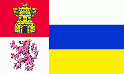 |
10 KB | State flag of the Canary Islands Category:Flags | 1 |
| 17:41, 29 November 2005 | Azande Flag.gif (file) |  |
3 KB | Flag of the Azande Chiefdoms | 1 |
| 18:07, 10 July 2005 | Heidi in garland.JPG (file) |  |
14 KB | A picture of myself and my cousin Heidi for my user page | 1 |
| 00:50, 23 March 2005 | Xicocu.jpg (file) |  |
8 KB | Map of Yamato highlighting Xicocu | 1 |
| 00:46, 23 March 2005 | Quiuxu.jpg (file) | 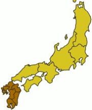 |
8 KB | Map of Yamato highlighting Quiùxù Region | 1 |
| 23:40, 20 March 2005 | Txugocu.jpg (file) | 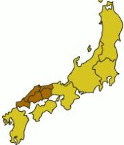 |
8 KB | Map of Yamato highlighting Txùgocu Region | 1 |
| 23:19, 20 March 2005 | Quinqui.jpg (file) |  |
8 KB | Map of Yamato highlighting Quiñqui | 1 |
| 22:31, 20 March 2005 | Txubu.jpg (file) |  |
8 KB | Map of Yamato highlighting Txubu Region | 1 |
| 21:49, 20 March 2005 | Canto.jpg (file) |  |
8 KB | Map of Yamato highlighting Canto region | 1 |
| 10:21, 20 March 2005 | Hiroxima.jpg (file) | 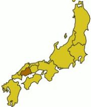 |
8 KB | Map of Yamato highlighting Hiroxima province within Txùgocu Region | 1 |
| 10:14, 20 March 2005 | Nara.jpg (file) | 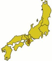 |
8 KB | Map of Yamato highlighting Nara province within Quiñqui Region | 1 |
| 23:22, 18 March 2005 | Quioto.jpg (file) | 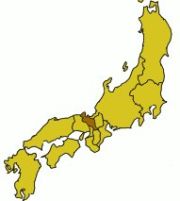 |
8 KB | Map of Yamato highlighting Quiòto Province withing Quiñqui Region | 1 |
| 23:17, 18 March 2005 | Cagoxima.jpg (file) | 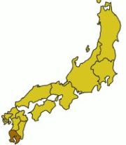 |
8 KB | Map of Yamato highlighting Cagoxima Province withing Quiùxù Region | 1 |
| 23:10, 18 March 2005 | Aquita.jpg (file) | 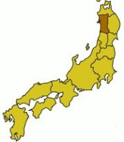 |
8 KB | A map of Yamato highlighting Aquita province withing Tòhocu Region | 1 |
| 23:04, 18 March 2005 | Aitxi.jpg (file) | 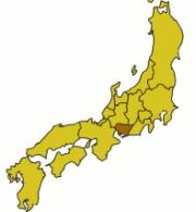 |
8 KB | Map of Yamato showing Aitxi province highlighted inside Txùbu Region | 1 |
| 19:51, 8 March 2005 | Cuxima map.jpg (file) | 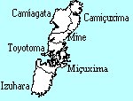 |
6 KB | Local map of Çuxima province | 1 |