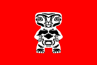
Azande Chiefdoms

| |
| Languages | |
| Official | French |
| Other | Local languages |
| Capital | Lisala (?) |
| Important Cities | |
| Independence | from France |
| (declared) | 15 August 1960 |
| (recognized) | 15 August 1960 |
| Currency | |
| Organizations | ? |
History
After French Central Africa was granted independence, three states emerged: Gabon, Centrafrican Republic and French Congo.
French Congo achieved full independence on August 15, 1960, with Fulbert Youlou as the first president. Forced to resign after a revolt in 1963, he was succeeded by Alphonse Massamba-Débat. In 1964, the new president founded a Marxist-Leninist party and proclaimed a non-capitalist path of economic development. A five-year plan was initiated, and the state sector of the economy in agriculture and industry was expanded. Tensions between the government and the army grew, and in 1968, Marien Ngouabi, an army commander, launched a coup which started the civil war that led to the eventual destruction of the state. French Congo fell into civil war at the time of the first change of government. The central government collapsed, and a number of chiefdoms and statelets emerged, along with some territory that was occupied by outside powers, notably Kongo.
When Bokassa took power in the Centrafrican Republic in 1966 and started to conquer the various chiefdoms and statelets, these statelets merged into four confederations, based on ethnic lines, to help defend themselves against Centrafrican aggression. These states were Mongo-Kongo, Luba, Lunda, Azande Chiefdoms, Kivu and others. During the Congolese civil war the Centrafricans conquered some Azande lands, which subsequently were retaken. The Azande Chiefdoms then expanded, taking some ethnically Azande land from Centrafrica (as the border was drawn by the French).
Geography
Borders
Centrafrican Empire and Ethiopia to the north, Ethiopia to the east, Native States of Africa to the south, and Mongo-Kongo to the west.
Area
The borders start at Lisala (DR Congo *here*), east along the Congo River to Bumba (DR Congo), northeast to Bondo (DR Congo), east along the Uele River, then the road to Aba (DR Congo) and on to Yei (Sudan), northwest to Obo (Central African Rep), 50km north and roughly parallel east along the Bomu River, then a sharp southwards turn north of Gbadolite to that town, then south to Lisala.
| This article is a proposal
|
The borders follow the northern border of *here*'s Zaïre from the road between Aba and Yei, then follow as far as Mobaye, go straight to Lisala and go east along Congo River to Bumba (DR Congo), northeast to Bondo (DR Congo), east along the Uele River, then the road to Aba (DR Congo). It thus covers the northern parts of *here*'s Equateur and Orientale provinces of the Democratic Republic of Congo.