Tawantinsuyu
From IBWiki
Jump to navigationJump to search

| |
| Cities | |
| Capital | Qusqu |
| Coordinates | latitude: 13° 31' 30" S longitude: 71° 58' 20" W |
| Government | constitutional monarchy |
| Head of State | Sapu Inka Yáhuar Huácac II |
| Head of Government | |
| Demonym | |
| Founding | c.1200 |
| Independence | November 1, 1835 |
| Area | ? km² ? mi² |
| Population | ? |
| Ethnicities | Quechua Aymara Other indigenous European |
| Languages | |
| Official | Quechua Aymara Castilian |
| Other | Numerous indigenous |
| Religions | Inti worship Roman Catholicism |
| Currency | 1 sol ($) = 20 reales (R) = 240 centavos (₵) |
| Time zone | UTC - -5:00 |
| ISO Code | TNS |
| International Vehicle Registration Code | TNS |
| Telephone Code | |
| Organizations | Andean Pact |
| Sports | |
| Official | |
| Other | |
Toponomy
In Qhichwa, tawa means four and -ntin is a suffix denoting a group, so that a tawantin is a group of four things taken together. The Empire is divided into four suyu ("regions" or "provinces"), whose "corners" meet at the capital, Qusqu. In Spanish the name is transliterated as Tahuantinsuyu. The name Tawantinsuyu is, therefore, a descriptive term indicating a union of provinces.
Government
Tawantinsuyu, Constitution of
Administrative Divisions
- Tawantinsuyu is a unitary state divided into four provinces (suyu).
- Chinchasuyu, the northwestern province, takes its name from the province, or ethnic province, of Chincha.
- Antisuyu, the northeastern province, takes its name from the Anti province and the Anti ethnic group that inhabited it. Anti, when transliterated into Spanish, becomes Andes.
- Kontisuyu, the southwestern province, is named after the region of Konti within the province.
- Qullasuyu, the southeastern province, is named after the Qolla peoples located on the northern shores of Lake Titicaca.
License Plates
- License plates in Tawantinsuyu are issued by the provinces.
- The license plates in each province are of a different color:
- Chinchaysuyu, red
- Antisuyu, green
- Kontisuyu, white
- Qullasuyu, yellow
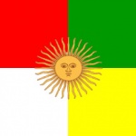
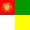
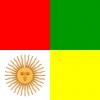
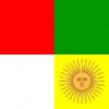
- The license plates of the Federal District are colored quarterly like the flag.
- There is a two-letter alpha prefix. The first letter designates the wamani (county) in the province. The second letter designates the vehicle's use.
- C (ciudadano) – privately owned
- G (gobierno) – government owned
- E (empresa) – company owned
- P (policia) – police
- M (militar) – military - the location designation for such vehicles shall be that of the wamani in which the military base for which the vehicle was purchased is located.
- The plates shall be issued in sequential order from 0001 to 9999. When 9999 is reached, an alphanumeric designation shall be used: A001 to A999, B001 to B999, etc.
- If the vehicle is sold, inherited or totally destroyed, the plates are returned to the Department of Motor Vehicles. A new owner must re-register the vehicle.
- These plates are to be placed on both the front and the back of the vehicle, with the exception of bicycles, motorcycles, and animal-drawn conveyances.
- License plates for vehicles belonging to the diplomatic corps shall be those used for the Federal District with the nation's international license plate code as the alpha prefix. Cars bearing these plates have diplomatic immunity.
History
History of Tawantinsuyu
Geography
Borders
Tawantinsuyu is bordered:
- on the north by Perú
- on the east by Paraná and Paraguay
- on the southeast by Riu de l'Argent
- on the south by Chile
- on the west by Perú and the Pacific Ocean
The Provinces
Chinchaysuyu (Northwest Suyu)
- Chinchaysuyu is the second largest of the four provinces, encompassing both the Peruvian coastal strip and the Andean highlands north of Qusqu, as well as much of modern-day Ecuador and a small segment of what is now southern Colombia. The Qhapaq Ñan, or Great Inca Road, ran the length of Chinchaysuyu, connecting the Inca capital of Qusqu with Quitu.
- The province contains distinctly different and geographically defined cultures from the coastal lowlands, the Andean highlands and the tropical eastern foothills of the Andean range. In order to maintain greater control and stability in the province, the Sapa Inkas allowed these different ethnic groups to retain many of their own beliefs and traditions.
- This suyu takes its name from the province, or ethnic province, of Chincha.
Antisuyu (Northeast Suyu)
- Antisuyu spreads out to the north and northeast of Qusqu.
- The vast Peruvian Amazon served to restrict the eastern expansion of the Antisuyu province. The Incas made few attempts to penetrate beyond the edge of the jungle that lay on the eastern foothills of the Andean range. They saw the deep jungle as a savage land populated by equally savage people.
- But the tropical forests east of the Andes did provide a number of important products such as hardwoods (used for weapons), feathers, wax and honey. The jungle was also an important source of medicinal herbs and hallucinogens (used in religious ceremonies and rites of passage).
- Warriors, traders and explorers ventured east into the dense lowland jungles, but due to the difficult geography, Inca occupation of the province was not a priority. As such, Antisuyu remained a comparatively small province with a distinct lack of infrastructure (in terms of roads and major settlements).
- This suyu takes its name from the Anti province and the Anti ethnic group that inhabited it (Anti, when Hispanicized, became Andes).
Kontisuyu (Southwest Suyu)
- Kontisuyu is the smallest province in Tawantinsuyu. It extends southwest from Qusqu until it reachs the Pacific Ocean.
- Geographically, the province is dominated by the dry foothills of the western highlands and the arid desert plains that stretch from modern-day Arequipa to the southern coast of Peru.
- Architecturally, the Incas adapted their construction style in the province to reflect that of local cultures more accustomed to the hot and dry climate. As such, fine Inca masonry as found in the highlands often gave way to adobe bricks along the coast of the province.
- Konti was a province within the suyu, after which the province was named.
Qullasuyu (Southeast Suyu)
- Qullasuyu is the largest of the four provinces, encompassing Peru’s southern highlands and the Bolivian Altiplano (Andean Plateau) before pushing all the way south into central Chile and a large strip of northwestern Argentina.
- Qullasuyu covers much of the Aymara and Uru territories. It also contains a number of major holy shrines, most notably those found in the Titicaca province. As such, Qullasuyu holds a special place within the Empire, as both an important spiritual and political province.
- Named after the Qulla peoples who lived on the northern shores of Lake Titiqaqa.
The Federal District of Qusqu
- The city of Qusqu extends throughout the Huatanay river valley. Located on the eastern end of the Knot of Qusqu, its elevation is around 3,400 m (11,200 ft). To the north is the Wilkapampa mountain range with 4,000 m – 6,000 m high mountains. The highest peak is Sallqantay (6,271 m) about 60 km (37.28 mi) northwest of Qusqu. Qusqu has a subtropical highland climate. It has an ideal temperature for daytime comfort all year round. Its climate is generally dry and temperate, with two defined seasons. The dry season lasts from May to August, with abundant sunshine, and occasional nighttime freezes; July is the coolest month with an average of 9.7 °C (49.5 °F). The wet season lasts from December to March, with night frost less common; November averages 13.3 °C (55.9 °F). Frost and hail are common, but it has snowed only once, in June 1911. Temperatures usually range from 0.2 °C (32.4 °F) to 20.9 °C (69.6 °F), but the all-time temperature range is between −8.9 °C (16.0 °F) and 30 °C (86.0 °F). Sunshine hours peak in July. In contrast, February has the least amount of sunshine.
Economy
Culture
The public holidays of Tawantinsuyu
| Date | Name | Notes |
|---|---|---|
| January 1 | Mary the Mother of God | rank of solemnity; January 2 if January 1 falls on a Sunday |
| 1st Monday in February | Birthday of the Sapa Inka | Official date |
| Good Friday | ||
| Easter Monday | ||
| May 1 | St. Joseph the Worker | Rank of solemnity; May 2 if May 1 falls on a Sunday; El Día del Trabajo |
| 1st Monday in June | Father's Day | |
| June 24 | Inti Raymi | Annual Festival of the Sun |
| 1st Monday in July | Flag Day | |
| 1st Monday of August | Election Day | in election years |
| September 24 | Our Lady of Mercy | Rank of solemnity; patronal feast of the Empire - September 25 if September 24 falls on a Sunday |
| 3rd Monday in October | Birthday of the Qoya, Mother's Day | Official date |
| November 21 | Constitution Day | November 22 if November 21 falls on a Sunday; the constitution was promulgated in 1964 |
| December 24 | Christmas Eve | unless it falls on Saturday |
| December 25 | Christmas Day | Rank of solemnity; if December 25 falls on a Sunday, then December 26 as well |
National symbols
- National mammal: Llama (Llama glama)
- National bird: Andean condor (Vultur gryphus)
- National flower: qantu (Cantua buxifolia)
- National tree: cinchona (Cinchona officinalis) (quina)
- National cuisine: Andes: pachamanca
- National instrument: siku
- National colors: red, green, yellow and white.
Religion
Inti Worship
Catholicism
Catholic Dioceses of Tawantinsuyu
Catholic holy days of obligation
| Date | Name | Notes |
|---|---|---|
| January 1 | Mary the Mother of God | rank of solemnity |
| Good Friday | ||
| May 1 | St. Joseph the Worker | Rank of solemnity |
| August 23 | St. Rose of Lima | Rank of solemnity |
| September 24 | Our Lady of Mercy | Rank of solemnity |
| December 25 | Christmas Day | Rank of solemnity |


