Talk:Bohemia
From the archives
(moved here from the Russia page)
CZECKIA/BOHEMIA
(the peace treaty of Versailles ended the war with the conclusion that the pre-war situation was restored)
This means that the Czech lands were not united with Austria even before the war. I think that one of the most important differences from OTL was that Rudolf II did not catch syphilis and so he did not suffer periods of dementia and so he was not forced by his family to resign in 1611. His descendants were ruling Czech lands, while the descendants of his brother Matthias were ruling only Austria and Hungary. Because Rudolf conceded religious freedom to the Protestants and did not tried to rescind them (unlike Matthias *here*), *there* was not the Second Defenestration nor the election of Frederick Faltz "the Winter King" nor the Battle of the White Mountain in 1620 and no "Period of Darkness".
As *there* was no need for the Czech National Revival movement, the people who run it *here* must *there* find something else to work on. Fortunately, *there* still lived some descendants of the Boii Celtic tribe who were not assimilated and were still keeping their language, so the linguists and political leaders could go in for the Boi National Revival movement.
One of the reasons why the Celts *there* preserved their language is that there were many of secret believers of the Palmian religion, but that is another story.
[The problem here is that it has been thus far established that non-Gaelic Celtic (i.e., insular P and Continental) is dead apart from Armorica in the Channel Isles and two dialects thereof, one that survivied in Brittany for a while at least, and a secretive one in Dunein, (which most certainly does not exist, never has existed, the idea of it is preposterous!)]
(Silesia was lost by Maria Theresia in war with Prussia.)
Czech Kingdom was probably the ally of Austria in this war against Prussia. Both Czech Kingdom and Austria were ruled by Habsburgs, even though *there* it were two separate branches of the family.
(How could happen if Rudolf II. succeeded in Bohemia and the Austro-Hungarian Empire did not go through its "real" history.)
There was Austro-Hungarian Empire *there*, only nowhere is stated that the Lands of Czech Crown were part of it (at least I did not find nothing, but of course it is possible that I overlooked something). So I think that the Austro-Hungarian Empire was *there* only what its name says: Austria as one part of it and Hungary (including the Upper Land) as the other part.
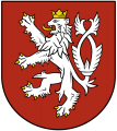
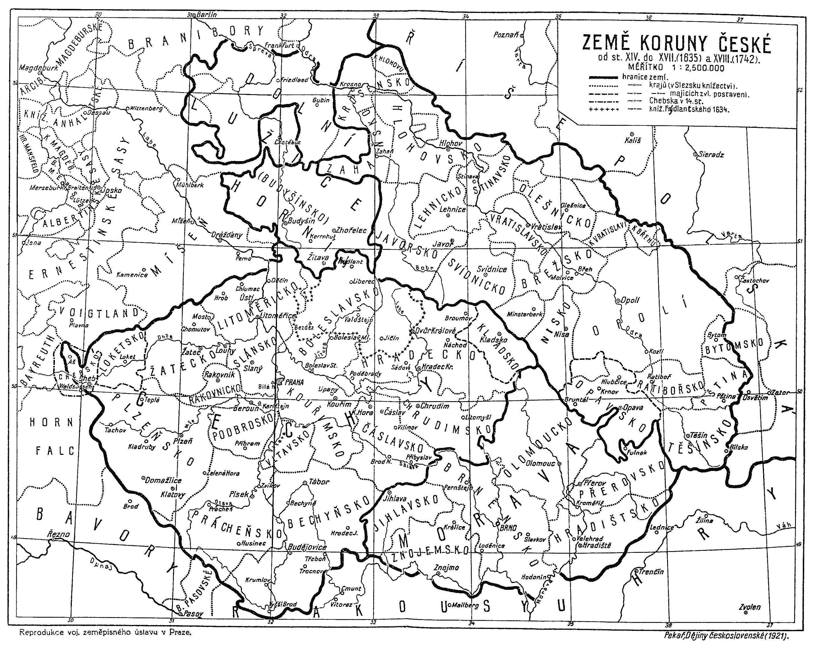
Map
I'd prepare map of Bohemian Kingdom in Bohemian. It is stylized in my previous maps pattern. I'm not sire if I did not some spelling mistakes so Jan II pleas do check it (I used Great Master Plan, because phrase book is unavailable). Follow by white rabbit 21:06, 21 August 2010 (UTC)

- wow! if i would be so good with graphic editiors...
- perfect work, small corrections go this way: Krýn Perk > Krýnperk, Óplä > Ópäln, Katóvic > Kotovic, Karlsbot > Kórlspót, Pilsä > Pilsän, Kénik Krec > Kénikrec, Ten Temokratí Téch..., Ésterajch > Ésterejch, Slevanaj > Slevonój, Ten hópti štad > Ten hóptštotäl, Ten Pevelkerunk > Ten Pefelkerunk, Ten Flech > Ta Flechna, Ta fana > Ta fána. I still consider to change GMP in a sense a > ö (closed o), o > o (open o), but i have no clue how to use it when long, maybe ő ;) so then eg. Kotovic would be Kötovic. anyway, i love the map! Jan II. 06:51, 24 August 2010 (UTC)
- Here you have, spelling correct. I must say that I have some problems with Bohemian norther border shape. It seems that in maps made by IJzeren Jan RTC and HRE have some scarps of both Silesia where RTC doesn't even have most of Upper Silesian Mining region, only Piniat (*here* Sosnowiec) but there is Silesian province witch is quite questionable for me. In other hand we can assume that Kotovic (*here* Katowice) had never been even build and having some more space Piniat grew up gaining all the territory of RTC's part of this region and I should change city in map to *here* Gliwice or even Bytom. But this thing that you need to agree with IJzeren Jan, I'm ready to make all changes you wish. There was also some problem with Lusitania, borders was to fuzzy, so I need to take a look into *heres* historical maps of that region and improvise.
- If you like I can also upload bigger versions of flag and coa. I do all my graphics in vector editor, but uploading .svg files is still unavailable in IB wiki. Follow by white rabbit 10:10, 24 August 2010 (UTC)
- the historical border of silesia runs right in the middle of kotovic/katowice and piniat/sosnowiec, as it looks on our maps. both places are quite old (early medieval), although sosnowiec was granted municipal right 1902, whereas katowice few hundred years ago.
- as for the lusatia, the hoyerswerda (the bay between kotpus/cottbus and paucän/bautzen) and bischofswerda areas (the bay between paucän/bautzen and schluckenau foreland, which is the left "horn" of *here*'s czech republic) belong to bohemian kingdom, not to saxonia, bohemia has never lost parts of lusatia to hohenzollerns (they received new march and brandenburg, but not cottbus area), look here, this map has only one flaw, glatz/kladsko belongs to bohemia, it was taken and added to silesia by prussians *here*.
- and please, upload your versions of the CoA and flag, they are much nicer than mine original :) thanx Jan II. 12:38, 24 August 2010 (UTC)
- Ok, so here u have both bigger and lesser CoA with flag. As for map here I found a bit "newer" map form XIV to XVIII century. Beside this funny corridor to Chotebuz its seems to be more/less as this map you linked but much more precise. So if you want I can change my map's shape of Lusitania including this Chitebuz corridor in Bohemia. As for Silesian border I will wait to IJzeren Jan, because I need also to change my maps of RTC and Europe then. Follow by white rabbit 13:29, 24 August 2010 (UTC)
- yes, the map u have linked is more precise and more or less has the wanted borders shape. and definitely, let us wait for jan I., i may try to attract his attention via skype message.
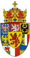
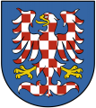
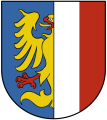
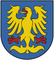
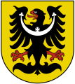
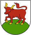
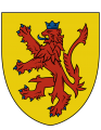
- as for the bigger CoA. looking closely and comparing, u have corrected one of my heraldic errors, which was putting the "sub"-CoA in wrong order in my original one, but i have found also errors in yours. methinks it should be: upper row from (heraldic) left - lower silesia, bohemia, moravia; middle row - upper silesia and teschenland (halved shield, left part also halved with red and silver horizontal fields, right part golden eagle on blue field); lower row - lower lusatia (silver shield with red bull on green grass) and upper lusatia (golden spire on blue shield), the heart shield contains red lion on golden field with blue arms; also all heraldic figures, except for bohemian and hapsburgian lions should have no crown, see these. the small CoA and flag are perfect. could you make a new one, pls? ;) Jan II. 17:54, 24 August 2010 (UTC)
OK. I made a gallery to have a better view. So I'd prepare two versions of CoA, first without *heres* Opava silver-red shield and second one with it. It is up to you witch one you prefer. Do you also wish to upload separate CoAs for all "Lonti" and lesser CoA without the crown and flag without the shield? Follow by white rabbit 21:17, 24 August 2010 (UTC)
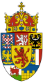
Bohemia COA Bigger version #1
Bohemia COA Bigger version #2
Bohemia COA Lesser
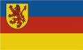
Bohemia flag


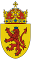
- i would say the ver.1 is ok, heraldically and according to the administrative division (opava region was originally part of upper silesia *here* before prussian division). wow, it would be perfect, if you could upload also the land CoAs, lesser CoA without the royal crown and shieldless flag! may i ask you also for the same in a case of nassland? u seem to be more friendly with computer graphics than poor me :) i would upload them also to my webpages and give u there a credit for them. Jan II. 08:33, 25 August 2010 (UTC)
- Your wish is and order for me. So here you got, all requested images plus one bonus! I made additional design of Bohemian lesser civil CoA based logotype in order to use as governmental logo and in promotional porpoises or whenever you want ;-). As for Nassland flag and CoA see Nassland discussion page. Follow by white rabbit 13:45, 25 August 2010 (UTC)
Pémän
Mérän
Tešänlont
Ópär Šlésijän
Nítär Šlésijän
Ópär Lausic
Nítär Lausic


Bohemia Civil symbol
Bohemia proportional logotype
Bohemia Civil flag (ensign)


- i like the bonus quite a lot, dziękuję bardzo, szanowny panie! Jan II. 16:30, 25 August 2010 (UTC)
- Your welcome! Všechny moje potěšení, Vážený Pane! Follow by white rabbit 20:53, 25 August 2010 (UTC)

Here you got redone map of Bohemia. I marked it as a proposal because it changes significantly borders of RTC and HRE, so must be accept by others. Follow by white rabbit 09:37, 26 August 2010 (UTC)
- it is fine with me (there are only three minor spelling errors: ta fána, ten fapän, Kórlspót) and let it open to comments! :) Jan II. 11:40, 26 August 2010 (UTC)
Being the Bohemian Kingdom a federative monarchy wouldn't the lonti have their own flags?--Pedromoderno 00:42, 27 August 2010 (UTC)
- Probably they would, most of them is wide know form *here*, I just wondering about Lusatians' flags. Are u challenging me ;-) ??? Follow by white rabbit 08:58, 27 August 2010 (UTC)
- No, I'm not challenging you. Just thought it would be interesting the possibility of each lonti having their own flags. Of course if you want to make some flags you will be free.--Pedromoderno 00:55, 28 August 2010 (UTC)
![[1]](https://upload.wikimedia.org/wikipedia/commons/a/af/Flagaluzycgornych.png)
![[2]](https://upload.wikimedia.org/wikipedia/commons/e/ee/Flagaluzycdolnych.png)
- Perhaps there could be flags with CoAs (state flags like in *here* German landers) and without CoAs for civil use.--Pedromoderno 00:13, 16 September 2010 (UTC)
- ok, good idea. and would it be heraldically acceptable, if the CoAs would be in the left upper corner (at a flagpole), like within the state flag?
- and, btw, jan I. already knows about the new bohemian borders and is ready to contribute in a short time (week or so). Jan II. 06:39, 16 September 2010 (UTC)
Sudetendeutsche
How much are Germans living in Bohemian lands distinguished from ethnic Bohemians? Does/did the concept of "Sudetendeutsche" exist *there*? Juan Martin Velez Linares 13:12, 21 September 2015 (CDT)
does the answer count after 10 yrs? :) there are no sudetendeutsche as they were in pre-WW2 czechoslovakia. linguistically, there are peripheral dialects of bohemian, which are part of the german language continuum, turning more german outwards bohemia. politically, there were just germans organised around deutsche heimatspartei and das bund, who thought that no bohemians existed, that they were just germans speaking weird dialect (almost like austrians :D ) after the second great war, they were politically disbanded and slightly prosecuted, but later on became again politically active (die deutsche in böhmen), although today with a much lower tendency to reunite with german empire, but rather to celebrate united culture under the vision of the greater german nation, opposing the anti-german official policy. they can hardly make it to parliament, having very low (< 4 %) popular support. ethnically, out of a circa 17 mill. inhabitants of BK, around 1 mill. proclaims german ethnicity, the majority proclaims bohemian nationality. only a few tens of thousands are anti-systemic anti-bohemian volksdeutsche (that might be the best analogue to sudetendeutsche). Jan II. (talk) 03:45, 6 January 2025 (PST)