File:Altacalifornia.jpg
From IBWiki
Jump to navigationJump to search

Size of this preview: 558 × 600 pixels. Other resolution: 600 × 645 pixels.
Original file (600 × 645 pixels, file size: 137 KB, MIME type: image/jpeg)
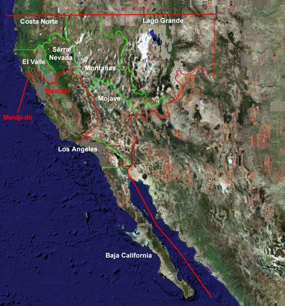
Map of Alta California and Provinces.
Here you can see the 8 major provinces:
- Costa Norte
- El Valle
- Sêrra Nevada
- Montañas
- Lago Grande
- Mojave
- Los Angeles
- Baja California
The eight provinces were created based roughly upon their geography. You can also see Montréi and Meidji-dò shown as well.
File history
Click on a date/time to view the file as it appeared at that time.
| Date/Time | Thumbnail | Dimensions | User | Comment | |
|---|---|---|---|---|---|
| current | 00:16, 27 July 2005 | | 600 × 645 (137 KB) | Doobieous (talk | contribs) | Map of Alta California and Provinces |
You cannot overwrite this file.
File usage
The following 2 pages use this file: