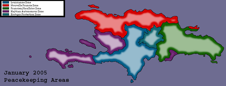
Hayti Consolidation Maps
The Following series of maps was developped by IBAP. It is used with their permission.
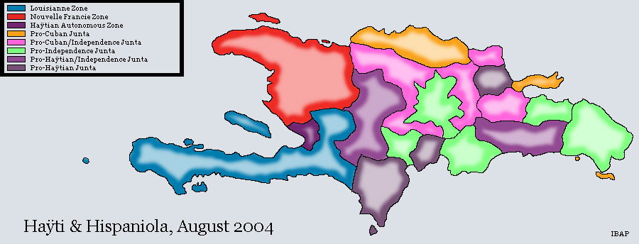
Prior to the landings of New Francians and Louisiannan troops, Hayti and Hispagnola were quickly fragmenting. The landing of these troops helped to stabilize the former nation of Hayti enough for DieuDonné III to land and assert his Empire.
This map shows the unrest that developped north of Port-Au-Prince and the advancement of peacekeeping troops.
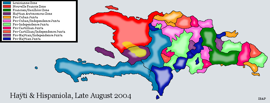
Note the landing of French forces to help stabilize the island in a shorter timeframe. Note also the arrival of New Francians troops along the western peninsulae of the Former Dominican Republic.
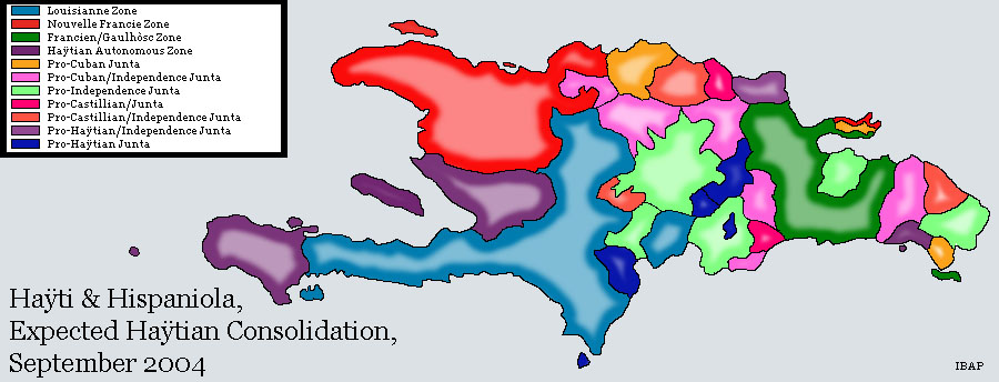
Note the expansion and consolidation of peace-keepers, as well as the insertion of a 'World Ecotopic Reserve,' supported by the arrival of Oregonian troops.
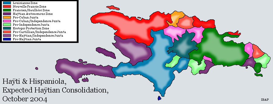
These are the approximate zones of the peackeeping troops. The troops have encountered some resistance in the northern regions, but it is believed that this will be put to rest in the next months prior to the Referendum.
