File:Ibpasaulis5.PNG
From IBWiki
Jump to navigationJump to search

Size of this preview: 800 × 530 pixels. Other resolutions: 2,560 × 1,696 pixels | 3,172 × 2,102 pixels.
Original file (3,172 × 2,102 pixels, file size: 469 KB, MIME type: image/png)
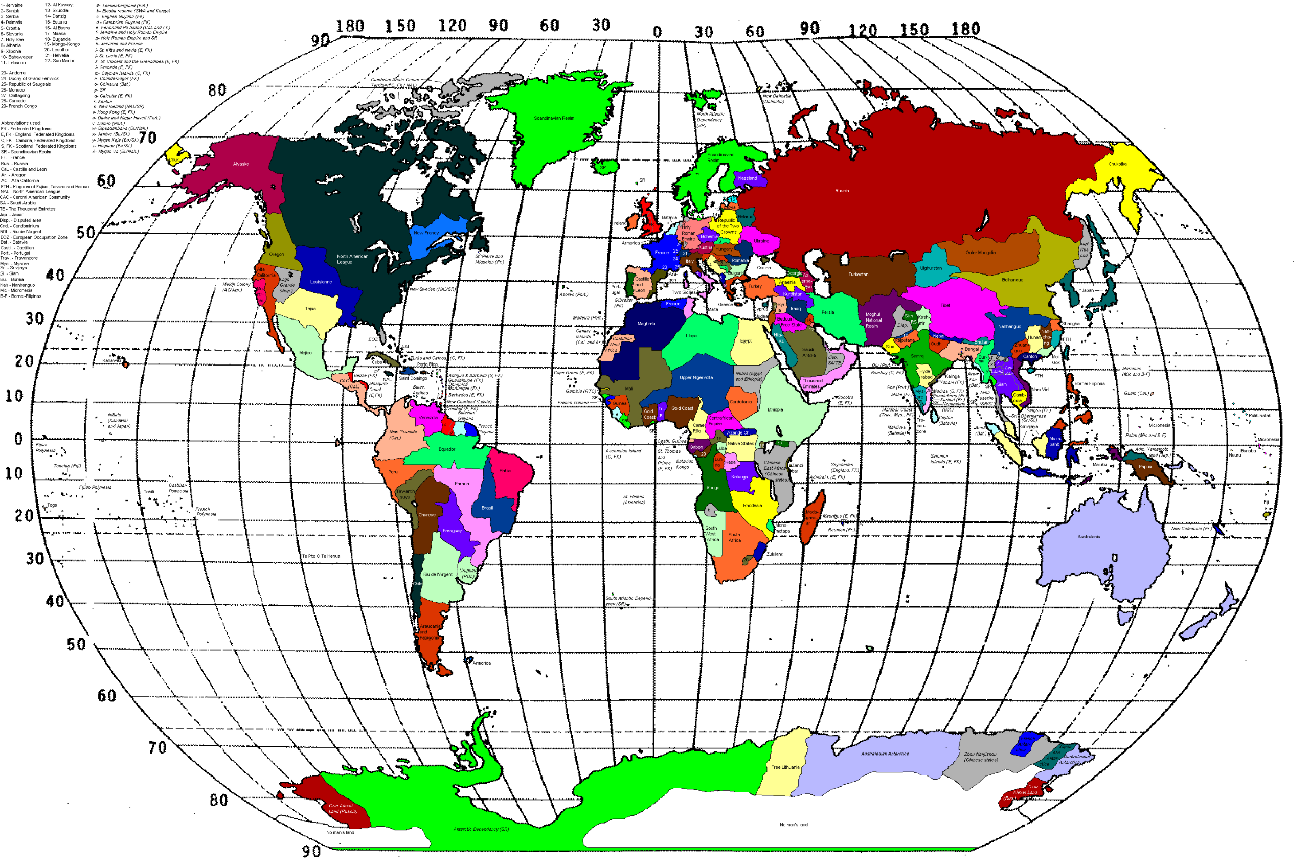
The world map
This page was created by Abdul-aziz. |
File history
Click on a date/time to view the file as it appeared at that time.
| Date/Time | Thumbnail | Dimensions | User | Comment | |
|---|---|---|---|---|---|
| current | 09:01, 4 January 2008 | | 3,172 × 2,102 (469 KB) | Benkarnell (talk | contribs) | Fixed lines of latitude and longitude around Guinea |
| 09:33, 23 December 2007 |  | 3,172 × 2,102 (469 KB) | Benkarnell (talk | contribs) | New verison showing Islamic Kingdom of Guinea | |
| 14:38, 5 December 2007 |  | 3,172 × 2,102 (468 KB) | Benkarnell (talk | contribs) | ||
| 02:08, 13 September 2006 |  | 3,172 × 2,102 (466 KB) | Sikulu (talk | contribs) | ||
| 11:32, 10 September 2006 |  | 3,172 × 2,102 (465 KB) | Abdul-aziz (talk | contribs) | ||
| 01:15, 10 September 2006 |  | 3,172 × 2,102 (465 KB) | Abdul-aziz (talk | contribs) | ||
| 06:28, 31 August 2006 | 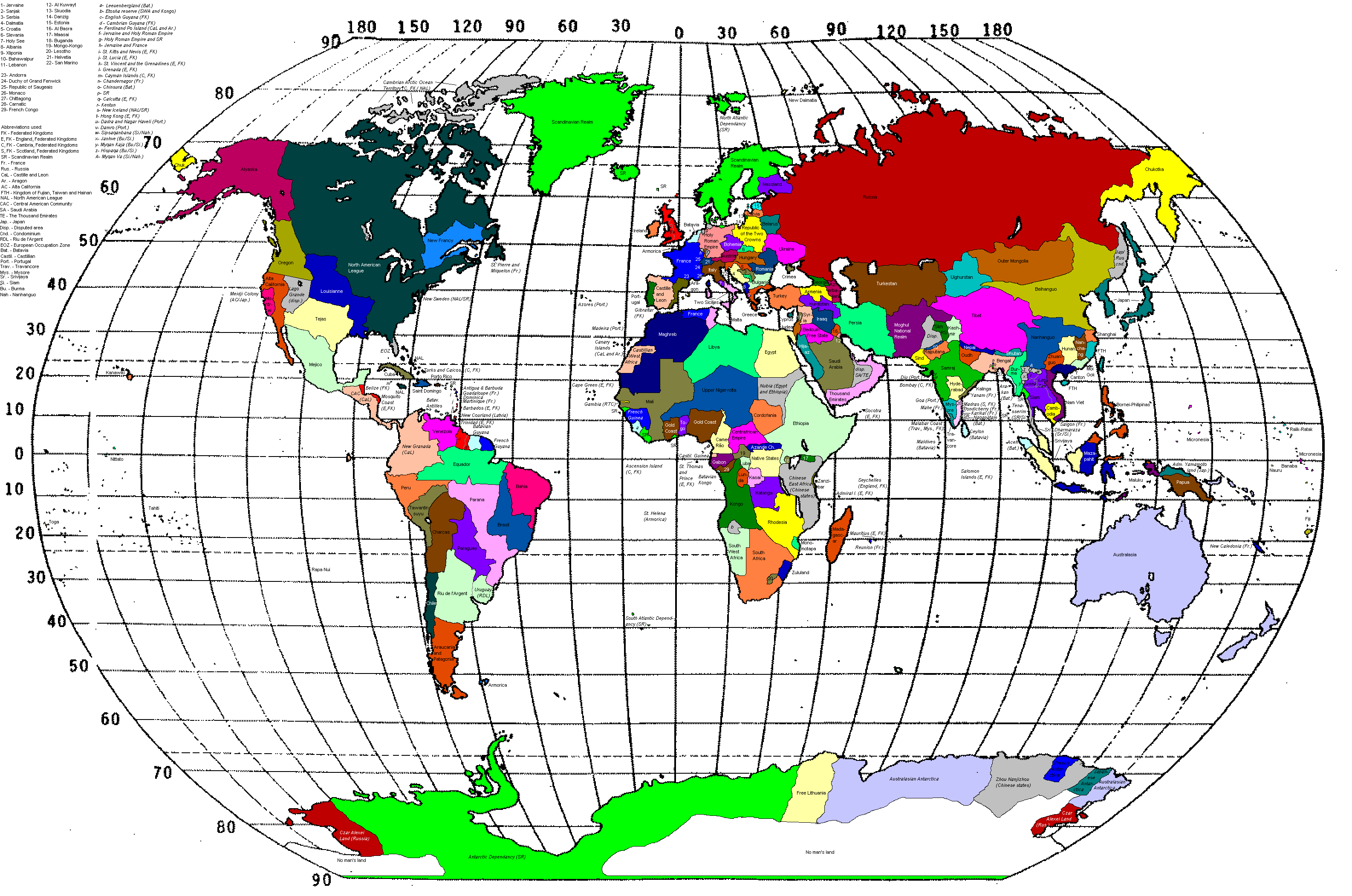 | 3,172 × 2,102 (466 KB) | Sikulu (talk | contribs) | ||
| 09:43, 12 July 2006 |  | 3,172 × 2,102 (465 KB) | Abdul-aziz (talk | contribs) | ||
| 01:12, 12 July 2006 |  | 3,172 × 2,102 (465 KB) | Abdul-aziz (talk | contribs) | ||
| 01:09, 12 July 2006 |  | 3,172 × 2,102 (464 KB) | Abdul-aziz (talk | contribs) |
You cannot overwrite this file.
File usage
The following page uses this file: