File:Osnabruck map.PNG
From IBWiki

No higher resolution available.
Osnabruck_map.PNG (285 × 246 pixels, file size: 5 KB, MIME type: image/png)
Osnabruck within the Königriek Hanover
File history
Click on a date/time to view the file as it appeared at that time.
| Date/Time | Thumbnail | Dimensions | User | Comment | |
|---|---|---|---|---|---|
| current | 22:57, 16 February 2009 | | 285×246 (5 KB) | Geofturner (Talk | contribs) | (cause i'm completely Lysdexic and put up the wrong map) |
| 05:28, 5 December 2008 | 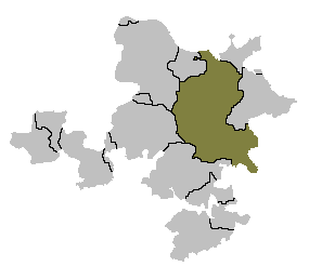 | 285×246 (5 KB) | Geofturner (Talk | contribs) | (Osnabruck within the Königriek Hanover) |
- Edit this file using an external application (See the setup instructions for more information)
File links
The following page links to this file: