File:Cambrian Provinces.png
From IBWiki
Jump to navigationJump to search

Size of this preview: 459 × 600 pixels. Other resolution: 995 × 1,300 pixels.
Original file (995 × 1,300 pixels, file size: 447 KB, MIME type: image/png)
Sources
- Coastlines: wikipedia:File:Roman Roads in Britannia.svg
- Kemr: Image:Kemrprovinces.png
- Dumnonia: https://ib.frath.net/w/File:Western_Isles.PNG
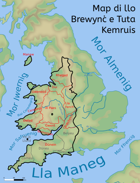
Legend
- Black lines: Cambrian Borders
- Red lines and text: Provinces
- Grey lines and text: Dumnonian Tutas
- Blue text: Aquanyms
File history
Click on a date/time to view the file as it appeared at that time.
| Date/Time | Thumbnail | Dimensions | User | Comment | |
|---|---|---|---|---|---|
| current | 21:07, 10 August 2025 | | 995 × 1,300 (447 KB) | Legovd101 (talk | contribs) | Category:Maps of the FK Category:Kemr ==Sources== *Coastlines: wikipedia:File:Roman Roads in Britannia.svg *Kemr: Image:Kemrprovinces.png *Dumnonia: https://ib.frath.net/w/File:Western_Isles.PNG ==Legend== *Black lines: Cambrian Borders *Red lines and text: Provinces *Grey lines and text: Dumnonian Tutas *Blue text: Aquanyms |
You cannot overwrite this file.
File usage
The following page uses this file: