Talk:Hazard
Initial Feedback
I'm interested to see what the gameboard looks like. BoArthur 16:51, 18 August 2008 (UTC)
Could we use the world map except obviously change the borders, recolor some areas, and change the names? The world map is a bit big though ome maybe Ben's political map would be be handy also. Misterxeight 17:05, 18 August 2008 (UTC)
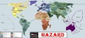
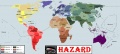
I've made a rudimentary map of Hazard (Bahia is a little small, sorry. Guyana and Suriname might be a little messed up too). Just where would Greece, Turkey, Xliponia, the Carriban, and Cyprus fall under?
![]() Mr.X8 Talk Contribs13:58, 13 October 2008 (UTC)
Mr.X8 Talk Contribs13:58, 13 October 2008 (UTC)
- I'm guessing Greece, Cyprus and Turkey are rolled into Balkans. If Turkey were the size it was *here* I'd say Caucasus, but since it's smaller, I'd say Balkans. BoArthur 18:10, 18 August 2008 (UTC)
- On Risk it's grouped into Middle East, and I think that that looks the best.
- As far as rules go, Tom Chapel suggested alternate units like airships. That's a possibility. For gameplay, it might be worth looking at versions of Risk that have more territories than the standard: "Lord of the Rings Risk" has a larger map, I think, and it has some rules that make use of the large map, like a larger number of continents. Maybe Asia in Hazard is split into 2 continents?
- Benkarnell 18:16, 18 August 2008 (UTC)
Whoops. For Russia it might look a bit weird since there is no official Russia. Like for instance, Ukraine might be a bit too big. Misterxeight 18:18, 18 August 2008 (UTC)
- Xliponia: wherever Greece goes (Vuçenni craihi!) Kyrmse 18:21, 18 August 2008 (UTC)
Hehe, I'm glad that this interested so many people. It might be best to create a whole new map: like Risk, Hazard must use a stylized rather than a naturalistic representation of the world. Not everything is the exact same size as it is in real life. The Atlantic and Pacific Oceans, for example, are probably compressed so as not to waste space on the game board. Maybe something hand-drawn, or photoshopped from a real Risk board, would look better than a Wikipedia-style map. Benkarnell 18:24, 18 August 2008 (UTC)
- Wow, that would be "different in a cool way," I think :) Benkarnell 18:36, 18 August 2008 (UTC)
Can I still show you guys the map? Misterxeight 18:29, 18 August 2008 (UTC)
And should Denmark be filed under the SR?
![]() Mr.X8 Talk Contribs13:58, 13 October 2008 (UTC)
Mr.X8 Talk Contribs13:58, 13 October 2008 (UTC)
- Oh, if you've made it already, go ahead and upload it. And it probably doesn't matter with Denmark; whatever's easier to draw and play with, I'd think. Benkarnell 18:35, 18 August 2008 (UTC)
- Yes and Yes. BoArthur 18:36, 18 August 2008 (UTC)
Finally, I finished it

- Looks pretty good. Africa looks fine, and so does Europe. I would colour the SE Asian islands green to go with Australasia, and would reduce the number of countries in Asia. Perhaps add the purple one to Corea-Japan and add the light blue one to China. In North America, combine Montrei and A-C and perhaps Tejas and Mejico or Tejas and Louisianna. Florida should either be part of the NAL or else part of some Caribbean/Central American country. New France should either be part of the NAL, or else create a new country out of the eastern swath of the Arctic (include all those grey islands, New France itself, Nunavik and the blue bits to the north of Hudson's Bay. Any thoughts on Antarctica? Elemtilas 03:32, 19 August 2008 (UTC)
Free for all? 13:17, 19 August 2008 (UTC)
- Don't worry about it? None of the Risks I've ever played bothered with it. I think Tejas and AC could be combined--more than LA and Tejas, anyway. But LA by itself is about as good as "Eastern Europe" in *our* Risk...nothing but a meat grinder. BoArthur 13:45, 19 August 2008 (UTC)
- I think AC and Tejas should stay separate; it just about balances out in North America that way, and I think it fits that just as IB has more countries than our world, so Hazard has more countries than Risk. On the map, "Baltic" seems too big, and a lot of that Arctic shoreline should be divided up between "Ukraine", "Ural", and "Siberia". Also, the countries list has "Hudson's Bay" as a separate country from "Solemn League"; I had imagined that it would incorporate the UT (plus New Iceland), but with a more old-timey name. As an aside, I move that this be the game that we play at the next Sociedad meeting. Benkarnell 15:27, 19 August 2008 (UTC)
- Only if you've paid your £6 dues. BoArthur 16:31, 19 August 2008 (UTC)
- I've roughly hand-drawn a more stylized game board, and Tejas definitely needs to go. I think combined with Mejico, though. Benkarnell 22:40, 22 August 2008 (UTC)
Well let's see it! Misterxeight 23:25, 12 October 2008 (UTC)
Tokens and Cards


- It occurred to me that we might like to take a look a the game tokens. Zahir 20:28, 22 August 2008 (UTC)
- Would the Blimps be 10's, the tanks 5's and little men 1's? BoArthur 21:29, 22 August 2008 (UTC)
- Beautiful :) Benkarnell 22:40, 22 August 2008 (UTC)
- I never did get an answer on the pieces -- so I'm assuming that what I suggested above is correct? --BoArthur 17:47, 4 June 2009 (UTC)
Here's my thought for one of the cards. --BoArthur 20:04, 4 June 2009 (UTC)
- Very nice! Are the tokens actual pieces from some other game, or were they created specifically for Hazard? I would assume that the soldier tokens would be some kind of miniature foot soldier? One supposes that by now, in IB, Hazard has gone through a couple generations like Risk has *here*, and probably has a nice anniversary set of high quality wood game cabinet with solid bronze tokens available. Only three quid and nine! Elemtilas 21:51, 9 June 2009 (UTC)
- I can't vouch for the pieces done by Zahir, but yes, I think you're right on the money with the iterations of Hazard *there*. --BoArthur 22:29, 9 June 2009 (UTC)
Game Board

Country breakdown
connection points v1

connection points v2

connection points v3
Tentative choice


I've felt inspired the last three days, and based on the list on the page, I've created the four versions listed above. As I worked out the board, I found that there are a great deal more connection points, and a higher chance for there to not be the choke points (i.e. Iceland, Indonesia) so that you can blockade it and build up and build up and build up....
What do you all think? -- BoArthur 17:53, 4 June 2009 (UTC)
- Beautiful maps! They look so "game board-y".
- I always imagined Russia a bit more dismembered, like it is in MrX8's sketch up above. Hence the anti-Russian bias that the Snorists found. So I would put Novgorod-Petrograd in with the Baltic; and Qazaqstan and possibly one or two other Turkic republics in with Turkestan. Also, I imagined Manchuria as consisting of Manchuria, Russian Primorye, and the Russo-Japanese condominium all mashed together; Beihanguo would then be part of China. But that's just what was in my head when I first made the list. Benkarnell 22:45, 4 June 2009 (UTC)
- I'll default to you and have no qualms changing it -- what do you think of the different connection points I suggested? I've printed off a copy of this and am going to play it this weekend (إن شاء الله) with the different connection points, and hopefully decide which ones I like.
- Let me know if you would like me to change it. --BoArthur 23:15, 4 June 2009 (UTC)
- Ha! I do like the idea of more connection points - a possible symbol of the IB nations' greater "interconnectedness". Let us know how the games go. Benkarnell 02:57, 5 June 2009 (UTC)
- I sooooo wish I were able to give some reliable feedback other than "Those maps are pretty." (Which they are). Zahir 15:25, 5 June 2009 (UTC)
- Have you never played Risk? It's a great deal of fun -- and strategy. --BoArthur 15:53, 5 June 2009 (UTC)
- Once, I think. About three decades ago. Zahir 01:30, 6 June 2009 (UTC)
- I just had a question and one teensy nitpick. I was wondering if the Sudan and Ethiopia could be rolled together to balance out Africa; I mean Southern Africa is huge. Another question; would you say the map is mainly based on geograhpy than ethnic lines? I was just wondering because looking at Risk; it seems their map is purely geographic areas. Misterxeight 18:32, 5 June 2009 (UTC)
- My map is roughly the states as they are here, but clumped together (mostly) in larger groupings. I think you made your comments before I updated the map -- with the new map and adjusting of sizes of Sudan, Chinese Africa and Kongo and South Africa, what do you think? --BoArthur 20:17, 5 June 2009 (UTC)
One other thing -- does everyone like the colors? Or should I make South America more red? --BoArthur 15:57, 5 June 2009 (UTC)
- Me, I think South America appears too close in colour to Asia. Perhaps a series of reds darker than Africa's colours? Elemtilas 14:02, 6 June 2009 (UTC)
For the actual game, I've just thought, wouldn't this be interesting if it were a scroll of some sort that would be unfurled? (the edges would have little weights in them to hold it down. What do you think? (I'm just thinking something uniquely IB.) --BoArthur 18:30, 5 June 2009 (UTC)
- I like the idea of a limited edition scroll Hazard game, but I think hard cardboard would be the norm. Seth 01:26, 6 June 2009 (UTC)
- I've played a different game (Railway Rivals, I think it was called) on a board like that that unrolled. Very different, and it allowed for playing the same game on new territory maps, but after a while in the tube it came in, the boards got so used to being rolled up that they wouldn't stay unrolled. What I mean is, it might be different, but it might get impractical after a bit. Geoff 01:32, 6 June 2009 (UTC)
- As far as other comments go, I've often wondered about dividing the oceans up into zones too, bigger than the land territories and each one connected to some part of coastline (i.e. no midoceanic zones), and introduce some more fluid movement rules allowing you to move troops between any ocean zones you have adjoining coastline of, and allow for the possible interdiction of your troop movements by other players who control adjoining coastal territories. But that might get complicated, and I have only the vaguest idea how to actually make that playable by casual players. Still, perhaps it's something to think about? Geoff 01:32, 6 June 2009 (UTC)
- For that, you might have to introduce some kind of naval game pieces -- can't just have massive armies trooping across oceans without boats! Elemtilas 14:02, 6 June 2009 (UTC)
A question: Why was Bornei-Filipinas changed to "Indonesia"? I don't think the name Indonesia even appears in IB anywhere. Elemtilas 14:02, 6 June 2009 (UTC)
- The name came from my original list. I assumed that Indonesia was the name for the whole region in IB, based on Roger Mills' website. The area is more than Bornei-Filipinas, after all - it's Mazapahit, Srivijaya, Aceh, etc. etc. Benkarnell 15:26, 6 June 2009 (UTC)
.PNG)
I don't want to be the jerk here, but this is what I had in mind for Manchuria.
- No -- not being a jerk, just making your point. and no worries -- I just don't know that I could see it taking in all of Primorye. I'll think about it (and probably go along with your suggestion, to tell you the truth.) BoArthur 20:26, 8 June 2009 (UTC)
- I've looked up Manchuria on the ever-true Wikipedia, and picked the definition of Manchuria that fit more or less with what I had in mind, but is closer to your candidate. What do you think, Ben? --BoArthur 21:41, 8 June 2009 (UTC)
- Purely aesthetically, I prefer the look of the Japan with a little more mainland territory. I also like the slightly larger Manchuria, without that big thumb sticking down into its middle. But does the addition or lack of that bit of land NE of Corea affect how Japan plays in the game?Elemtilas 14:50, 9 June 2009 (UTC)
- I don't think it does, and I agree with you both. Giving the condominium area to Japan highlights a big difference in the world IB, if nothing else. Benkarnell 14:54, 9 June 2009 (UTC)
Connection Points, Redux
connection points v1
connection points v2
connection points v3
Tentative scenario
I'm leaning toward something like 2 or three. What do you all think? --BoArthur 17:32, 8 June 2009 (UTC)
- It seems three has more connecting lines, and I think that might make more sense. I like how South America connects to Polynesia, too. Not a major complaint, but the connecting lines are kind of easy to confuse with the border lines, especially between SE Asia and Australasia. Can the borders be made with a dotted line or something quite distinct from the connecting lines? Elemtilas 19:01, 8 June 2009 (UTC)
- Aside the dashed line -- did you have something in mind? I'm open to suggestions -- I only put in the ocean borders because Hazard has a lot more island territories, and I wanted those clear -- in Risk, they're virtually disregarded as a place to fight over. BoArthur
- The amended country game board with altered colours and labels looks really spiffy. Can't wait to see it all put together! Elemtilas 19:01, 8 June 2009 (UTC)
Rules
Have you thought much more about how the rules might be different? Elemtilas 19:01, 8 June 2009 (UTC)
- I've thought of
- making it a rule to declare a capital and to have a penalty if you should lose your capital, effective until you re-captured it.
- using a card from "Castle Risk" where you decide one territory where you have a "fifth column" that you can bring once in a time of need, but making it so it's not the same territory as your capital.
- Dunno...what do you think? BoArthur 20:26, 8 June 2009 (UTC)
- What sort of penalties? Perhaps if a certain number is rolled on the dice, a peripheral territory could be lost to the enemy?
- I was thinking more like this: If your capital is captured, you have a 1/3 (or something) reduction on reinforcements for 3 turns (or something) until a government in exile can re-assert itself, possibly with a -1 army reduction until the capital is recaptured.
- On the other hand, what positive effects does having a capital offer?
- Maybe something like controlling the continent on which your capital is located gives you a +2 army reinforcement?
- I like the fifth column idea. What would happen if an enemy took that territory before the player could use his fifth column?
- Typically, in Castle Risk, I would whip out my fifth column either when I was attacking from that territory and needed a boost, or when my opponent was attacking that territory and it was critical I win. You receive the number of reinforcements the number of traded cards is at at that time, so it pays to sit on it until later in the game.
- Would it transfer to the conqueror, or would they escape to another of the original player's territories Elemtilas 14:56, 9 June 2009 (UTC)
- They would actually remain imbedded until you could recapture the territory, essentially, and, somewhat obviously, they were only usable once. --BoArthur 16:15, 9 June 2009 (UTC)
On the idea of having a capital city, I found an Italian version of the game, S.P.Q.Risiko, that seems to have city game pieces. Might be interesting to look into this as a resource. It seems to be a little more complex than the "seize all the capitals to win" version called Capital Risk. Elemtilas 21:51, 9 June 2009 (UTC)
- Interesting -- not that I could get my hands on an italian set, but I could see a particular piece on the board to serve that purpose. --BoArthur 22:28, 9 June 2009 (UTC)
- Actually, I just found the reference at Gameboardgeek. There are English rules here: http://www.boardgamegeek.com/filepage/28731 Elemtilas 01:22, 10 June 2009 (UTC)
Box Design
Any thoughts yet as to packaging and box design? Elemtilas 21:51, 9 June 2009 (UTC)
- Possibly a scroll -- but most likely a box. With a quote from you along the lines of, "Cor! World Domination in a box?! Unthinkable!" and one from Geoff Sessions, "Yet another gaulish attempt to put their tomfoolery out there -- I wouldn't be caught dead playing it Larry, because you start playing it and next you know you're being visited by them Blue Martians!" --BoArthur 22:22, 9 June 2009 (UTC)