File:Ae-political-map.png
From IBWiki
Jump to navigationJump to search
No higher resolution available.
Ae-political-map.png (657 × 591 pixels, file size: 36 KB, MIME type: image/png)
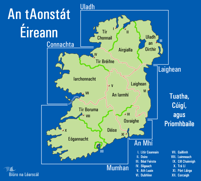
The Territories, Provinces, and Primary Cities of Ireland. Uploaded by creator.
File history
Click on a date/time to view the file as it appeared at that time.
| Date/Time | Thumbnail | Dimensions | User | Comment | |
|---|---|---|---|---|---|
| current | 08:44, 24 August 2005 | | 657 × 591 (36 KB) | Kgaughan (talk | contribs) | The Territories, Provinces, and Primary Cities of Ireland. Uploaded by creator. |
You cannot overwrite this file.
File usage
The following page uses this file: